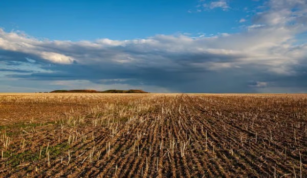
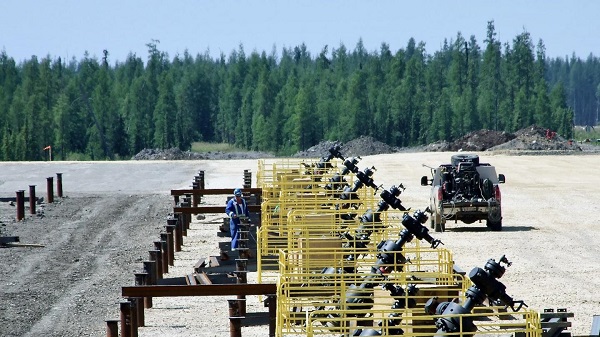
Agriculture
How USAID Assisted the Corporate Takeover of Ukrainian Agriculture
From the Brownstone Institute
A recent essay titled “The Real Purpose of Net Zero” by Jefferey Jaxon posited that Europe’s current war against farmers in the name of preventing climate change is ultimately designed to inflict famine. Jaxon is not speculating on globalist motives; he is warning humanity of a rapidly unfolding reality that is observable in the perverse lies against cows, denigration of European farmers as enemies of the Earth, and calls by the WHO, WEF, and UN for a plant-based diet dependent entirely on GMOs, synthetic fertilizers, and agrichemicals.
Revelations about the evil doings of the Orwellian-monikered “United States Agency of International Development” (USAID) reveal a roadmap to totalitarian control unwittingly funded by America’s taxpaying proles. USAID’s clandestine machinations have long focused on controlling local and global food supplies as “soft colonization” by multinational chemical, agricultural, and financial corporations. European farmers revolting against climate, wildlife, and animal rights policies are harbingers of this tightening globalist noose.
The roots of the current globalist plan to “save humanity from climate change” link directly to the infamous Kissinger Report, which called to control world food supplies and agriculture as part of a globalist collaboration between nation-states and NGOs to advance US national security interests and “save the world” from human overpopulation using “fertility reduction technologies.” Kissinger’s 1974 Report was created by USAID, the CIA, and various federal agencies, including the USDA.
Fast forward to 2003, the Iraq War justified using fear-mongering propaganda about weapons of mass destruction and neo-conservative malarky about rescuing the Iraqi people. The US-led occupation of Iraq became a rapacious profiteering smorgasbord for colonizing corporations husbanded by USAID. Iraq is heir to the birthplace of human civilization, made possible by early Mesopotamian agriculture: many of the grains, fruits, and vegetables that now feed the world were developed there. Iraq’s farmers saved back 97% of their seed stocks from their own harvests before the US invasion. Under Paul Bremer, Rule 81 (never fully implemented) sought to institute GMO cropping and patented seed varieties, as Cargill, Monsanto, and other corporations descended upon the war-ravaged nation using American tax dollars and USAID.
That playbook was more quietly implemented during the Ukraine War, once again orchestrated by USAID. Before the Russian invasion on February 24, 2022, Ukraine was the breadbasket of Europe, prohibiting GMO technologies and restricting land ownership to Ukrainians. Within months of US intervention, USAID assisted in the dismantling of these protections in the name of “land reforms,” free markets, financial support, improved agricultural efficiency, and rescuing the Ukrainian people. In just two years, over half of Ukraine’s farmland became the property of foreign investors. GMO seeds and drone technology were “donated” by Bayer Corporation, and companies such as GMO seed-seller Syngenta and German chemical manufacturer BASF became the dominant agricultural “stakeholders” in war-torn Ukraine. Russia may withdraw, but Ukraine’s foreign debts, soil degradation, and soft colonization will remain.
The UN, WTO, WHO, and WEF all conspire to peddle a false narrative that cows and peasant farmers are destroying the planet, and that chemical-dependent GMO monocropping, synthetic fertilizers, and patented fake meats and bug burgers must be implemented post haste (by force if necessary) to rescue humanity. The argument that pesticides and synthetic fertilizers (manufactured from natural gas, aka methane) are salvific is patently false. They are, however, highly profitable for chemical companies like Bayer, Dow, and BASF.
Jefferey Jaxon is exactly correct. The Netherlands committed to robust agricultural development following a Nazi embargo that deliberately inflicted mass famine following their collaboration with Allied Forces in Operation Market Garden. France boasts the highest cow population in all of Europe. Ireland’s culture is tightly linked to farming as part of its trauma during the (British-assisted) Irish Potato Famine. The corporate/NGO cabal now uprooting and targeting farmers in these nations and across the EU in the name of staving off climate change and preserving wildlife is a direct outcropping of Kissinger’s grand dystopian scheme launched through USAID in 1974.
Americans watch European farmer protests from afar, largely oblivious that most all of US agriculture was absorbed by the Big Ag Borg generations ago. Currency control linked to a (political, environmental, and economic) social credit scorecard promises the fruition of Kissinger’s demonic plan: “Control the food, control the people.”
Modern humans suffer a double hubris that blinds them to the contemplation of the truth of Jaxon’s hypothesis: a cultish trust in technology, coupled with an irrational faith in their self-perceived moral superiority to past civilizations (Wendell Berry calls this “historical pride”). Yet, as long as mankind has had the capacity to harm another for personal gain, humans have devised ways to control food for power or profit. Siege warfare generally depended on starving defenders of castle walls into submission.
Even if globalist food control proposals are well-intentioned, a monolithic, monocultured, industrial-dependent worldwide food system is a lurking humanitarian disaster. Berry observed:
In a highly centralized and industrialized food-supply system there can be no small disaster. Whether it be a production “error” or a corn blight, the disaster is not foreseen until it exists; it is not recognized until it is widespread.
The current push to dominate global food production using industrial systems is the cornerstone of complete globalist dominion over all of humanity. The “Mark of the Beast” without which no American will buy or sell goods – including guns, bullets, or factory-grown hamburgers and cricket patties – is mere steps away. Mr. Jaxon is correct that these leaders “know these basic historical and current facts,” and that “[f]armers are becoming endangered because of government [climate] policy … and it’s being allowed to happen.” USAID has been actively seeding and watering this dystopia for decades.
Klaus Schwab and Bill Gates are as fully cognizant of this fundamental truth as Henry Kissinger was in 1974. USAID has aided all three. Having lost almost all of their small farms over the last century, Americans are well ahead of Europeans in their near-complete dependence on industrial food.
That’s the plan.
Author

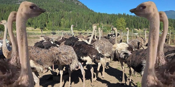


Former Minister of Agriculture Gerry Ritz wonders who’s really in control
Canadians have been watching with increasing anger and outrage. The world has been watching with disbelief that a once great democracy could have become a petty dictatorship where the rule of law is ignored by a government agency – and hence, by the federal government itself – that believes it has impunity from the law and is above that law.
I have been writing about the disaster unfolding in Edgewood, BC for six months now. The problems began almost a year ago at Universal Ostrich Farms with an outbreak of what was believed to be avian flu. The crisis erupted when the Canadian Food Inspection Agency (CFIA) and the RCMP invaded and occupied the farm almost four weeks ago. The death squad came to kill 399 ostriches. They expected no opposition. They got plenty. Then the Supreme Court of Canada agreed to consider the farm’s appeal of a recent decision by the federal court to allow the “cull” to continue despite there being absolutely no reason for doing so. As has been noted, the CFIA steadfastly refuses to test the ostriches for avian flu.
The court ordered a stay of execution.
The CFIA has brazenly but systematically taken over this farm and is doing everything to impair the health and end the lives of the remaining birds.
 |
It made perfect sense since the birds are healthy and have been for well over 260 days.
But the CFIA has ignored the court’s order and continued with an unofficial, piecemeal execution of the ostriches. The herd has diminished by perhaps 100 birds since the CFIA was given “custody” of the birds and the farm owners have not been allowed to feed or care for their ostriches and have instead had to trust the CFIA to do that. It was obvious from the start that these bureaucratic goons were doing anything but and in fact were cruelly mistreating the birds because, after all, they think this court order is just a temporary setback. So not only is the evidence of cruelty mounting, it is becoming obvious that the CFIA is continuing to kill the birds and remove their carcasses from the farm in dumpsters.
 |
Former Minister of Agriculture Gerry Ritz was also an ostrich farmer at one time in his busy life. He was also minister for eight years during the administration of Prime Minister Stephen Harper and he knows how the CFIA works – and doesn’t work. He has been following the saga at Universal Ostrich Farms very closely.
 |
“I think it’s become a debacle. The world is watching, and there’s no accountability for anything that’s being done out there. There’s a stay before the Supreme Court, but while that stay is in place, the CFIA has moved ahead with impunity to do whatever they think they’re going to need to do in the end. And I think that’s just morally and ethically wrong … They’ve gone way beyond any kind of budget capacity. They’re outspending anything I’ve ever seen them try to do,” said Ritz
“They’ve gone sideways again, and no one is calling them to task. There’s a number of people on social media. No one in the mainstream, other than, you know, “This Hour Has 22 minutes” that did a skit the other day, which I found was completely tasteless and offside. Well, that’s what they do, but at the end of the day this is a science-based organization, and I don’t see any science here. They have an opportunity to test the birds, and they refuse to do that.”
“I think it’s become a debacle. The world is watching, and there’s no accountability for anything that’s being done out there,” said Gerry Ritz
The video evidence of the neglect, maltreatment and cruelty is abundant. The CFIA has not only banned the family farm of Dave Bilinksy, Karen Espersen and her daughter Katie Pasitney from feeding the ostriches, these thugs are reluctant to do that task for them and the birds are clearly not just hungry but starving. The CFIA should have been charged weeks ago for violating basic animal cruelty laws. They should also be held accountable for treating an order from the Supreme Court of Canada with the same seriousness as an order at a fastfood restaurant.
 |
The CFIA has even occupied an adjacent farm simply because they wanted to build a road that would allow them to bypass the protesters on the farm and continue to do their work in secret. They have established an execution pen of hay bales inside a fenced-off area of the farm that the farm owners cannot enter. Katie and her family have lost control of their livestock, their farm and their livelihood. The CFIA is conducting its clandestine and dirty work with complete impunity. No one has been charged with cruelty, they operate above the law and control the scope of work performed by the police.
So, while the farm waits to discover the decision of the Supreme Court, time is potentially running out for the ostriches. When we learned that the court would not be responding for at least two weeks after Thanksgiving, it seemed like a good omen. Two weeks to continue to consolidate public opinion against the slaughter. Two weeks to demonstrate that this form of government overreach was not just directed at one farm or one herd of ostriches but against all farmers, all property owners, anyone who has a dog or a cat at home. The CFIA has brazenly but systematically taken over this farm and is doing everything to impair the health and end the lives of the remaining birds.
 |
There may not be a single ostrich left by the time the Supreme Court decides whether to hear the case or not. It may be a moot point and a decision without any purpose because the CFIA might have already disposed of all the ostriches, without any fear of legal consequences.
This story would be sufficiently tragic if it were only about the invasion and occupation of a family farm and the completely irrational and unnecessary decision to kill almost 400 ostriches. But it is about much more than that. It is about the Liberal government of Prime Minister Mark Carney having no respect for private property or the livelihood of farmers.
Ritz says it’s a toss-up between whether the CFIA has become a rogue agency or an agency following the orders of rogue federal government. “ think a little bit of both. Human nature tends to let you run wild if no one’s looking over your shoulder.”
“I cannot, for the like me, understand why SPCA aren’t screaming, you know, a lot more pushback than we’re seeing. Certainly they’re continuing to move ahead full steam, even while the Supreme Court decides whether they have this. [They’ve] decided to hear it, I understand, but at the end of the day, there’ll be nothing left to hear by the time they get there.”
This story would be sufficiently tragic if it were only about the invasion and occupation of a family farm and the completely irrational and unnecessary decision to kill almost 400 ostriches. But it is about much more than that. It is about the Liberal government of Prime Minister Mark Carney having no respect for private property or the livelihood of farmers. It is about a sanguinary government agency that has virtually nothing to do with public health but everything to do with killing animals. It is about the absolute refusal to the CFIA to test the birds for avian flu because the CFIA does not want to be caught in a lie or admit that herd immunity is far more effective than the vaccines that big pharma wants to sell and the Liberal government is clearly benefitting from.
This story is about your family farm, your house and backyard being occupied by the government with a trumped-up “warrant to search.” It is about your farmyard animals or your dog and cat being seized and killed by the CFIA because they say it is necessary. It is about a ravenous federal government not just “stamping out” healthy ostriches but stamping out basic liberties in Canada.
 |
Combined with the Carney government’s obsession to censor social media, confiscate a myriad of firearms from law-abiding gun owners who are largely farmers and establish a digital ID, the tragedy at the ostrich farm is about how a country that used to respect the rule of law and democratic protocol has slid into authoritarian rule that far too few Canadians tried to stop. We know the Carney government is heavily invested in avain flu vaccines that were purchased from the UK’s GSK. Is Mark Carney personally invested?
 |
Sources: https://x.com/TIME/status/
Does Ritz think this is all about doing the bidding of big pharma?
“Well, I’m not a conspiracy theorist, but I mean, when the chips start to fall on one side of the table, you really have to be conscious of where they’re piling up. And in this case, there’s a lot of unanswered questions. I just don’t understand how this has gotten as far as it has without some of those things being addressed,” he said asking, “Why are they refusing to test these birds?”
He noted that the cost of testing was about $100,000 when there were 399 birds still alive. “Now there are fewer. Why that would be an impediment when they’re probably spending that per day with everything they’re doing? Would that not be the ‘Get Out of Jail Free’ card for the CFIA and the RCMP to back away and say, ‘Hey, we’ve tested them. Now everything’s fine. We’re good,’” Ritz continued.
“So why they won’t test baffles the crap out of me, and that’s where, as minister, Heath MacDonald should step in and say, ‘Just get it done.’ It takes a few minutes per bird. They’ve already got the system to line them up and run them through. So why aren’t they doing that? I just can’t believe that they’re passing up this opportunity to build the science unless there’s someone calling the shots behind them who doesn’t want the science revealed.”
This article supplied by Troy Media.
Canada’s agri-food sector powers $90 billion in exports and one in nine jobs, yet it’s missing from the fed’s flagship infrastructure agenda
Prime Minister Mark Carney’s “nation-building” strategy may boast big wins for energy and infrastructure, but it sidelines one of Canada’s greatest economic assets: food.
His first five flagship projects—the LNG terminal in Kitimat, a small modular nuclear reactor in Darlington, the $1-billion Contrecoeur container terminal east of Montreal and mineral developments in B.C. and Saskatchewan—send a message that Ottawa is ready to build. But for all their ambition, they overlook the sector that feeds the country, powers $90 billion in exports and supports one in nine jobs.
Canada is one of the world’s great breadbaskets—reliable, safe and absurdly productive. The agrifood sector isn’t just farms and tractors; it’s one of the most advanced, innovative ecosystems we’ve got. And yet, among Carney’s first round of “nation-building” moonshots, food didn’t even get a seat at the table.
Sure, the expanded port in Montreal will help grain and processed food shipments. And yes, stable nuclear power might one day shave energy bills for processors and greenhouse growers. But these are trickle-down perks—not the kind of direct investment the sector actually needs. Food deserves its own spotlight.
This oversight isn’t just symbolic—it exposes real pressure points that threaten the entire system. Take Western Canada’s beef-packing bottleneck, for example: a few mega-facilities dominate the sector, so when one gets gummed up by a strike or shutdown, it sends shockwaves through the entire supply chain. Farmers are left holding the bag—and consumers feel the hit. Expanding and decentralizing capacity would help, but that’s just scratching the surface.
If Carney wants to prove Canada can be a food power as much as an energy one, we need projects with the same heft and urgency as those just announced. To match the ambition of Carney’s energy and infrastructure plans, here are five food-sector nation-builders that would move the dial:
1. The Prairie Gateway Grain and Pulse Terminal—a rail-linked export hub in Saskatchewan or Manitoba—would get lentils, peas, canola and wheat to global
markets fast. Think Contrecoeur, but for the Prairies.
2. Protein Supercluster 2.0 would string together state-of-the-art processing facilities to transform raw commodities into premium plant proteins, canola oil and biofuels. A second-generation government-backed innovation corridor, it would help Canada move from raw exports to value-added, export-ready, job-creating production.
3. A National Plant and Animal Science Campus, inspired by Wageningen University in the Netherlands—a world leader in agricultural research—would centralize the kind of next-gen crop science, livestock genomics and climate-resilient breeding Canada will need to compete in the decades ahead. Call it moonshot science; we’ve been staring at the ground too long.
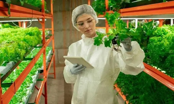
4. Northern Food Sovereignty Corridors, featuring investments in greenhouses, vertical farms and logistics, would reduce reliance on overpriced imports and bring fresh food, and economic independence, to northern and Indigenous communities. It would also move reconciliation from speech to action.
5. A Digital Food Traceability Network would use blockchain and AI to track food from seed to supper, slashing waste, boosting consumer confidence and giving our exports a transparency edge in an increasingly picky global market.
Carney’s five projects are a solid start. They prove Canada can think big. But a real strategy needs to feed people as well as power them. Agriculture can’t remain the forgotten cousin in economic planning.
The point isn’t to downplay the importance of energy or mining. Mines and reactors may fuel prosperity but it’s food—and the infrastructure, science and innovation behind it—that will secure it. Canada’s real strength lies not just under the ground but in the fields, labs and refrigerated supply chains that keep our plates full and our trading partners coming back for seconds.
Dr. Sylvain Charlebois is a Canadian professor and researcher in food distribution and policy. He is senior director of the Agri-Food Analytics Lab at Dalhousie University and co-host of The Food Professor Podcast. He is frequently cited in the media for his insights on food prices, agricultural trends, and the global food supply chain.
Troy Media empowers Canadian community news outlets by providing independent, insightful analysis and commentary. Our mission is to support local media in helping Canadians stay informed and engaged by delivering reliable content that strengthens community connections and deepens understanding across the country.


The City of Red Deer’s Financial Troubles: Here Are The Candidates I Am Voting For And Why.

UN, Gates Foundation push for digital ID across 50 nations by 2028

Click here to help choose Alberta’s new licence plate design
The Trials of Liberty: What the Truckers Taught Canada About Power and Protest

-
Alberta2 days ago
Click here to help choose Alberta’s new licence plate design
-
 National2 days ago
Democracy Watch Renews Push for Independent Prosecutor in SNC-Lavalin Case
-
 Alberta2 days ago
Busting five myths about the Alberta oil sands
-
 Frontier Centre for Public Policy2 days ago
Ottawa Should Think Twice Before Taxing Churches
-
 Business1 day ago
US government buys stakes in two Canadian mining companies
-
 Energy1 day ago
Minus Forty and the Myth of Easy Energy
-
 Health1 day ago
New report warns WHO health rules erode Canada’s democracy and Charter rights
-
 City of Red Deer2 days ago
Plan Ahead: Voting May Take a Little Longer This Election Day