Connect with us

Agriculture

Don’t Buy the Media Lies About Crop Production

Published

6 minute read

From Heartland Daily News

By Linnea Lueken

One of the mainstream media’s favorite pastimes in recent years has been trying to scare the pants off everyone by suggesting that climate change is decimating crop production around the world. They are either lying intentionally, or mistaken. However, in either case, there is some journalistic malpractice going on, as well as a notable failure of logic.

We have all seen the stories, the favorites of the media usually have to do with foods that are popular semi-luxury items, depending on where you live, like cocoa beans, coffee, and wine.

For instance, Forbes put out an article claiming that cocoa, olive oil, rice, and soybeans are all “particularly vulnerable” to the effects of “climate-induced stressors.” I will be looking at this article as a case study of sorts for the kind of bad journalism I am talking about.

I am not going to get into whether or not extreme weather is getting worse or not, or climate specific subjects in this op-ed. What I am aiming to do is debunk the climate-related alarmism surrounding food production.

That Forbes article in particular stuck out to me because I already knew from the second sentence that it was nonsense based on previous work I have done looking into production and yields for all the crops listed. First, the bait and switch: Forbes’ article title, “Climate Change’s Toll On Global Agriculture: A Looming Crisis,” and introductory paragraph contain no indication that what is about to be discussed actually is not a global problem, but a regional one, and sometimes the problem does not exist at all.

For cocoa beans, they focus on West Africa, for olive oil the Mediterranean region, for rice they chose Italy and India, and for soybeans the United States and South America. In each of those regions, the overall trend for their crop production is positive.

Globally, every single crop listed by Forbes, according to data from the United Nations Food and Agricultural Organization, has broken all-time records for production and yields year after year. On occasion, there is a less good year, but the trendline remains positive.

Since 1990, when the worst effects of climate change supposedly began to manifest, world production of cocoa beans has increased 132 percent, setting an all-time high in 2022. Olive oil has seen a rise of 124 percent. Overall rice production has risen 49 percent since 1990, and India alone saw a 75 percent increase. Soybeans, in part subsidized by the U.S. government, are certainly not struggling in this country, and worldwide soybean production has risen 221 percent.

All of this information is easy to find for the curious; you do not need to take Forbes’ or my word for anything.

This isn’t to say, again, that certain regions don’t suffer bad seasons, but this is a natural risk of farming, and nothing crop producers haven’t seen before. The media is fearmongering in order to weaken resistance to their preferred public policy goals.

There are, according to Our World in Data, around 570 million farms throughout the world. The vast majority of those are small farms, which make it exceedingly difficult for them to adapt to any weather, regardless of whether or not extreme weather is getting worse. Every single season, for every single crop, there is some region or individual farm suffering from poor yields due to the weather.

That is a whole lot of fodder for human-interest stories for propagandist journalists to choose between when they want to push a narrative. Since we are so connected worldwide now thanks to the internet and instantaneous communications, we get to hear about a wealth of stories that we never would have heard about otherwise, and likely would not even have been covered at all in the West. This generates a sense that crop failures are happening more often, but they’re not.

This also is not to say that global crop shortages do not or cannot occur – they do, they can, due to weather or geopolitical issues.

The best way to guarantee that those positive crop production trendlines reverse would be to ban the things the propagandists want us to ban, like diesel tractors, pesticides, and synthetic fertilizers. Just ask the farmer of Sri Lanka. Or ask the people who never had those things but would like to have them, like the subsistence farmers of Africa.

My advice is to dig a little deeper when the media hypes crop failures because in most cases there is more going on than our journalist gatekeepers admit.

Linnea Lueken ([email protected]) is a research fellow with the Arthur B. Robinson Center on Climate and Environmental Policy at The Heartland Institute. 

Originally published by The Center Square. Republished with permission.

Todayville is a digital media and technology company. We profile unique stories and events in our community. Register and promote your community event for free.

Follow Author

Agriculture

The Role of Satellite Imagery in Developing VRA Prescription Maps

Published on

Since its appearance in the 1980s, precision agriculture has revolutionized farming, offering innovative solutions to age-old challenges. One of those is Variable rate technology (VRT), which plays a key role in improving efficiency and sustainability in today’s farming methods.

By applying inputs like fertilizers and water in different quantities across the field, VRT helps optimize crop yields and reduce costs. This technology relies on data collection and analysis to create detailed VRA prescription maps, allowing for customized input applications. 

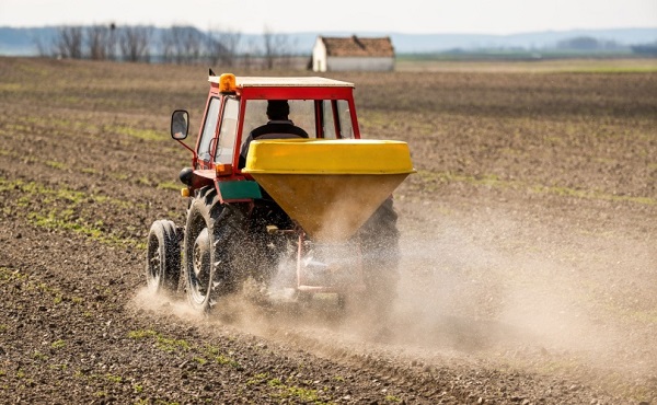
With the right equipment and technology, VRT can significantly improve agricultural productivity.  Today’s advanced tractors, equipped with built-in terminals and specialized software integrated with a precision agriculture platform, use prescription maps to accurately apply variable rates of water or chemicals based on GPS location and management zones.

Variable Rate Technology In Precision Agriculture

Precision agriculture is a game-changer, moving far beyond traditional farming methods. Often called satellite farming, this approach focuses on crop condition monitoring, measuring, and responding to variability within fields. One of its standout innovations is variable rate application (VRA), which has caught the attention of farmers worldwide for its immense potential.

Why is VRA so important? It goes beyond simply fertilizing, seeding, and applying pesticides. It’s about utilizing technology to apply various expendable materials on and beneath the field automatically. 

Farm management software simplifies contemporary farming by combining data and technology to improve farming efficiency, sustainability, and profitability. Precision agriculture platforms consolidate operations, crop health monitoring through satellite imagery, and offer real-time suggestions, enabling farmers to make informed decisions for the best use of resources (through VRA) and increased productivity.

Variable rate application offers numerous advantages for modern agriculture:

  1. VR fertilizer enhances farming efficiency.

Adjusting rates based on soil health and plant needs helps save resources and increase yields. Research shows this method can lead to higher net income and healthier soil compared to using uniform rates: “The net incomes of VR management zone were 15.5–449.61 USD ha−1 higher than that of traditional spatially uniform rate fertilization.”

  1. VR irrigation saves water, time, and fuel while reducing machinery wear.

Applying the correct amount of water to different parts of the field based on soil moisture levels and crop requirements reduces wear and tear on irrigation equipment compared to uniform irrigation.

Studies claim: “Variable rate irrigation (VRI) can increase water use efficiency and productivity by applying water based on site‐specific needs.”

  1. VR seeding increases crop yield by adjusting seeding rates based on soil fertility.

VR seeding adjusts seeding rates based on soil fertility and other factors to optimize plant populations and yields. It is commonly used alongside variable rate fertilization as part of a comprehensive precision agriculture strategy. 

Findings show that: “The application of VRS to the seeding of various crops shows positive agro-economic trends, additional yields, and higher economic returns.”

  1. VR pesticide reduces environmental pollution and improves pesticide efficiency.

VRT helps farmers target pests more accurately and use less pesticide. 

Studies have found that “VR management zone reduced the use of nitrogen (N), phosphorus (P), and potassium (K) fertilizers by 22.90–43.95%, 59.11–100%, and 8.21–100%, respectively, and it also increased the use efficiency of N, P, and K by 12.27–28.71, 89.64–176.85, and 5.48–266.89 kg/kg, respectively, without yield loss.”

This demonstrates the ability of variable rate technologies to improve pesticide effectiveness and reduce environmental pollution in agriculture.

Using Various Technological Means For Informed Decisions

Applying different technological tools is essential for implementing variable rate technology in agriculture. This includes smart machinery, fertilizers, seeders, soil sensors, geographic information system (also called GIS), and the Global Navigation Satellite System (GNSS) applications for field mapping. Additionally, having supporting infrastructure, which helps manage and analyze info from different sources, is crucial for successful implementation.

Understanding the location, timing, and methods for seeding, fertilizing, and harvesting is key in remote crop monitoring and precision agriculture, where data plays a vital role in managing resources effectively.

This information is taken from a wide variety of data sources.

  • Sensors. Moisture, soil nutrients, compaction, weather stations (humidity, temperature, wind speed)
  • Drones and satellite photography. Field hyperspectral imaging.
  • GNSS. Event coordinates, also points and times for obtaining time-series data
  • Spatio-temporal data sources. Spatio-temporal specific data (trajectories of agricultural machinery, spatiotemporal points, event points, time-series information)
  • Maps. Field boundaries, soil type, surface levels)
  • AI solutions. Prediction of weather conditions, detection of plant diseases.

However, simply collecting raw data is not sufficient. It is necessary to process this information to extract valuable insights, make informed decisions, and enable automatic alerts and control signals for agricultural equipment. Thus, you must have the capability to:

  • Gather data;
  • Transform the data to extract valuable insights for precision farming gear;
  • Upload the data into agricultural equipment;
  • Retrieve real-time data from tractors, seeders, fertilizers, and other machinery.

By following these steps, farmers can make the most of modern technology, optimizing their farming practices and boosting efficiency.

Use Of Satellite Images In Building VRT Maps

Satellite crop monitoring imagery can be used to generate different kinds of VRA maps for various purposes. As nitrogen is one of the most critical elements plants need, building map for its proper application is a major task. 

Nitrogen fertilization maps play a crucial role in optimizing the application of water, nitrogen, and crop protection products. 

When creating a VRA map for nitrogen fertilizer, you can choose from various indices that provide valuable insights:

  • MSAVI is sensitive to uncovered soil and, therefore, is ideal for planning VR fertilizer application in the early stages of growth.

Example:  Early in the growing season, a corn farmer uses MSAVI to detect patches of uncovered soil in their field. This helps them apply fertilizer more accurately, ensuring that nutrient-rich areas receive the right amount of input and promoting uniform growth.

  • ReCI measures chlorophyll content in leaves, helping to identify field areas with faded and yellowed vegetation that may need additional fertilizer.

Example: A soybean grower notices using ReCI that certain sections of their field have yellowed leaves, indicating possible nutrient deficiencies. They apply additional fertilizer to these areas, restoring plant health and boosting overall yield.

  • NDVI indicates biomass accumulation zones and areas with low vegetation that might demand larger amounts of fertilizer.

Example:  A cotton producer uses NDVI to map out zones with varying levels of biomass across their field. They adjust their fertilizer application rates, applying more in areas with lower vegetation to support growth and maximize their harvest.

  • NDMI is well-suited for VR irrigation by identifying areas that are under water stress.

Example: During a hot summer, a vineyard uses NDMI to pinpoint areas suffering from water stress. They adjust their irrigation system to provide extra water where it’s needed, ensuring the vines remain healthy and productive.

    • NDRE helps identify stressed or dying vegetation in the middle to late stages of a season, aiding in effective fertilization strategies.
  • Example: During the season, a wheat farmer uses NDRE to identify patches of the field where the wheat plants are showing signs of nutrient stress or poor growth. By applying a mid-season nutrient boost specifically to these stressed areas, the farmer improves the overall health and yield potential of the wheat crop.

Field Productivity Maps

Field productivity maps can be created by analyzing satellite images to pinpoint areas with high or low crop yields. By using the NDVI index and advanced machine learning algorithms, different productivity zones can be identified.

Key applications of productivity maps include:

  • Potassium and phosphorus fertilization

Historical productivity zones data can help avoid excessive application in areas where these nutrients may have accumulated with time.

  • Variable rate planting

Farmers can apply different seed amounts in various productivity zones to either maximize yield or achieve uniform distribution across the field.

  • Land evaluation

Field productivity can be assessed before purchasing or renting land; it helps reduce risk and enhance profitability.

  • Targeted soil sampling

Soil sampling efforts can be focused on key areas indicated by productivity data, rather than relying on generic grid sampling.

As you see, variable rate application (VRA) is a cost-effective method that can save you 10% on planting and cultivation costs based on the characteristics of the soil. To fully benefit from VRA, it’s important to understand the technologies involved, such as sensors, GNSS, earth observation pictures from drones and satellites, and digital maps, which provide crucial data for analysis and implementation. We sincerely hope that you succeed in your farming endeavors with modern technology!

______________

Author Vasyl Cherlinka

Vasyl Cherlinka is a Doctor of Biosciences specializing in pedology (soil science), with 30 years of experience in the field. With a degree in agrochemistry, agronomy and soil science, Dr. Cherlinka has been advising on these issues private sector for many years.

Continue Reading

Agriculture

Restoring balance between renewable energy, agricultural land and Alberta’s iconic viewscapes

Published on

Alberta is known around the world for many things – some of the most breathtaking and iconic scenery on earth, a world-class agricultural industry that puts high-quality food on tables across the globe and a rich history of responsible energy development. Alberta is a destination of choice for millions of visitors, newcomers and investors each year.

To ensure Alberta’s continued prosperity, it is imperative that future energy development is balanced with environmental stewardship, protecting Albertans’ ability to use and enjoy their property, and safeguarding agriculture for continued food security.

Alberta’s renewable energy sector has grown rapidly over the past decade, yet the rules to ensure responsible development have not kept up. As a result, municipalities, agricultural producers and landowners across the province raised concerns. Alberta’s government is fulfilling its duty to put Albertans first and restore the balance needed for long-term success by setting a clear path forward for responsible renewable energy development.

“We are doing the hard work necessary to ensure future generations can continue to enjoy the same Alberta that we know and love. By conserving our environment, agricultural lands and beautiful viewscapes, our government is protecting and balancing Alberta’s long-term economic prosperity. Our government will not apologize for putting Albertans ahead of corporate interests.”

Nathan Neudorf, Minister of Affordability and Utilities

Amendments to the Activities Designation Regulation and Conservation and Reclamation Regulation provide clarity for renewable energy developers on new and existing environmental protections.

These changes will create consistent reclamation requirements across all forms of renewable energy operations, including a mandatory reclamation security requirement. Albertans expect renewable power generation projects to be responsibly decommissioned and reclaimed for future generations. Alberta’s government stands firm in its commitment to protect landowners and taxpayers from being burdened with reclamation costs.

“We want to protect landowners, municipalities and taxpayers from unfairly having to cover the costs of renewable energy reclamations in the future. These changes will help make sure that all renewable energy projects provide reasonable security up front and that land will be reclaimed for future generations.”

Rebecca Schulz, Minister of Environment and Protected Areas

Alberta’s government committed to an ‘agriculture first’ approach for future development, safeguarding the province’s native grasslands, irrigable and productive lands. The protection of agricultural land is not only essential to food production, but to environmental stewardship and local wildlife protection.

The Electric Energy Land Use and Visual Assessment Regulation follows this ‘agriculture first’ approach and enhances protections for municipalities’ most productive lands, establishing the need to consider potential irrigability and whether projects can co-exist with agricultural operations. These changes are critical to minimizing the impacts of energy development on agricultural lands, protecting local ecosystems and global food security. With these new rules, Alberta’s farmers and ranchers can continue to produce the high-quality products that they are renowned for.

“Our province accounts for nearly 50 per cent of Canada’s cattle, produces the most potatoes in the country, and is the sugar beet capital of Canada. None of this would be possible without the valuable, productive farmland that these new rules protect. Understanding the need for an ‘agriculture first’ approach for energy development is as simple as no farms, no food.”

RJ Sigurdson, Minister of Agriculture and Irrigation

The new Electric Energy Land Use and Visual Assessment Regulation also establishes specific guidelines to prevent projects from impacting pristine viewscapes. By establishing buffer zones and visual impact assessment zones, Alberta’s government is ensuring that industrial power projects the size of the Calgary Tower cannot be built in front of UNESCO World Heritage sites and other specified viewscapes, which will support the continued growth and success of Alberta’s tourism sector.

As Alberta’s population and economy grows, it is critical that the province has the additional power generation needed to meet increasing demand. Power generation must be developed in a balanced and responsible manner that promotes environmental stewardship, ensures the continued enjoyment of Alberta’s beautiful landscapes, and safeguards food security by protecting Alberta’s valuable agricultural lands. By encouraging the responsible development of additional power generation with these new regulations, Alberta’s government is listening to Albertans and ensuring the electricity grid is affordable, reliable and sustainable for generations to come.

Summary of Policy Changes

Following the policy direction established on February 28, 2024, Alberta’s government is now implementing the following policy and regulatory changes for renewable power development:

Agricultural lands

The new Electric Energy Land Use and Visual Assessment Regulation takes an “agriculture first” approach.
• Renewable energy developments will no longer be permitted on Land Suitability Rating System (LSRS) Class 1 and 2 lands unless the proponent can demonstrate the ability for both crops and/or livestock to coexist with the renewable generation project,

• In municipalities without Class 1 or 2 lands, Class 3 lands will be treated as Class 1 and 2.

• An irrigability assessment must be conducted by proponents and considered by the AUC.

Reclamation security

Amendments to the Activities Designation Regulation and Conservation and Reclamation Regulation create consistent reclamation requirements across all forms of renewable energy operations, including a mandatory reclamation security requirement. There will be a mandatory security requirement for projects located on private lands.

• Developers will be responsible for reclamation costs via a mandatory security or bond.

• The reclamation security will either be provided directly to the province or may be negotiated with landowners if sufficient evidence is provided to the AUC.

Viewscapes

The Electric Energy Land Use and Visual Assessment Regulation ensures pristine viewscapes are conserved through the establishment of buffer zones and visual impact assessment zones as designated by the province.

• New wind projects will no longer be permitted within specified buffer zones.

o Other proposed electricity developments located within the buffer zones will be required to submit a
visual impact assessment before approval.

• All proposed electricity developments located within visual impact assessment zones will be required to submit a visual impact assessment before approval.

Municipalities

The AUC is implementing rule changes to:

• Automatically grant municipalities the right to participate in AUC hearings.

• Enable municipalities to be eligible to request cost recovery for participation and review.

• Allow municipalities to review rules related to municipal submission requirements while clarifying consultation requirements.

Continue Reading

Trending

X